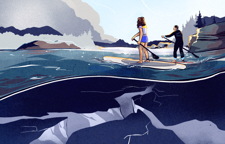
A Massive Earthquake Is Coming to Cascadia—And It Can’t Be Stopped
But it can be anticipated and mitigated. Meet four guardians of the Pacific Northwest.
If you look at a world map, Cascadia is shaped like a whale swimming south. British Columbia’s temperate rainforest forms the bulk of its body, along with Washington state, Idaho, and much of Oregon. Mountainous Vancouver Island is the pectoral fin. The tail extends north to the southern tip of Alaska, and the whale’s open mouth, facing south, just catches northern California.
Tall, dense forests of pine, spruce, and cedar blanket the bioregion. Aquatic species, from barnacles to sea otters, thrive in the pockets of habitat created by the coastline’s sinuous edges. Cultural touchstones—from Nirvana and Bob Barker to Father’s Day and the computer mouse—have their roots here.
By almost any measure Cascadia—a term born of the 1970s environmental movement to describe the Pacific Northwest’s geography and cultural identity—is a strange and beautiful place.
But just offshore from the postcard-worthy landscapes is a seismic threat as catastrophic as any on earth.
Back in 2015, a prominent New Yorker article sounded the alarm on Cascadia’s tsunami and earthquake problem. The story by Kathryn Schulz, titled “The Really Big One,” reminded some about—and introduced many more to—the Cascadia Subduction Zone (CSZ), a geological hotspot that rivals the famous San Andreas Fault.
Seven times in the past 3,500 years, the CSZ has buckled and fractured to produce an earthquake so massive that it left a mark in the geologic record. There’s a one-in-10 chance that the next major Cascadia quake will occur sometime in the next 50 years. The odds of a lesser but still major event are even greater.
Schulz’s story explains exactly what could happen should the CSZ shake the earth with its full seismic potential. Buildings would crumble, and thousands would die. It would be an unavoidable economic and humanitarian disaster from Vancouver Island to northern California. Worse yet, a magnitude-9 rupture along the CSZ could trigger the San Andreas as well.
But for most residents of the region, that threat is mounting far offstage. As life in Cascadia carries on—strong rain, stronger coffee, Birkenstocks aplenty—the COVID-19 pandemic has become public enemy No. 1. And for good reason: It’s hard to focus on an invisible fault line fracturing when a global contagion is actively killing people.
Yet the importance of disaster awareness here has never been greater. While no amount of knowledge or preparation can stop the unstoppable, both can mitigate the damage. Behind the scenes, an unlikely consortium of earthquake guardians has found common cause, working to alert Cascadia’s residents to the CSZ’s power. Scientists are mining the earth for data to predict the wheres and whens. Indigenous community leaders are readying the area’s coastal residents, some of the least prepared and most geographically vulnerable. And everyone is focused on training the next generation to pick up where their predecessors leave off.
Mary Leitka, David Yamaguchi, Brian Atwater, and Jessie Pearl are just four of the individuals working to understand the CSZ and help safeguard against it. Their hope is a shared one: that knowledge of what’s to come will help the region’s residents survive when the next megathrust earthquake rolls in.
The Protector
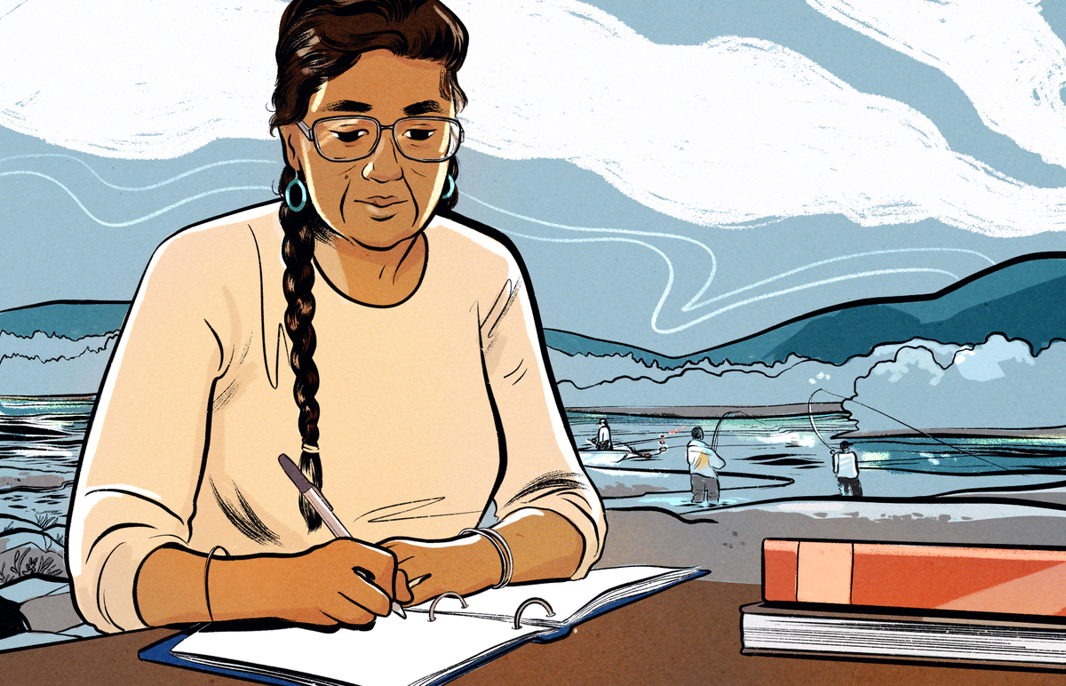
It’s just before the golden hour in a nondescript diner on the outskirts of Tacoma, Washington. Vinyl tablecloths cover the counters, and disco hits bubble beneath the restaurant chatter. Mary Leitka, a tribal elder, is recounting a Hoh legend centuries older than the building she sits in.
Thunderbird and Whale, she says, were two mythical beasts with supernatural strength who battled to the death. When Thunderbird thrust his talons into Whale’s back, Whale resisted being lifted from the water. In the ensuing struggle, Thunderbird’s wings flapped hard against the surface, causing the ground to shake and waves to ripple outward—waves that gave rise to the tsunamis that have lashed the coast of the Pacific Northwest for millennia.
Leitka vividly remembers the story’s intended message: When the ground quivers or the tide pulls away from shore, get to high ground. Back when she was a child living by the Hoh River, on the Olympic Peninsula, the Coast Guard would ring the family’s black-and-brown tsunami-dedicated telephone magneto. Everyone would evacuate the area and gather on a hill overlooking the lower Hoh reservation as rising waters—set in motion by earthquakes halfway around the world, in Japan and Chile—flooded the coast.
But Leitka wasn’t afraid. There was a system in place. Advanced warnings and neighbors helping neighbors meant there was little risk of injury, even when a particularly mighty wave devoured canoes and construction sites. Everyone knew who had vehicles and who needed extra help. Long before a formal division was organized for the task—FEMA wasn’t established by Jimmy Carter’s executive order until 1979—the Hoh people ensured each others’ safety. Casualties were so nonexistent, in fact, that funny moments—like the time a neighbor rushed out of his house wearing his wife’s pants—are what Leitka recalls. Not calamitous ones.
But those were simpler times. Before the seismic discovery of the Cascadia Subduction Zone. Before anyone knew the scale of preparation required to protect against a massive tsunami-generating earthquake—not half a world away, but just off the coast.
Now 72 years old, Leitka is the project coordinator for the Nisqually Emergency Management team. Her soft voice belies her unshakeable belief in her work, which is more essential today than it’s ever been. Just southeast of where she grew up, along the Hoh River, Leitka and nine other members of the team work to bring Nisqually preparedness measures up to speed—to mend the gap between the Indigenous community and the people at the forefront of the region’s emergency management and seismic forecasting. These relationships are critical, as the scale of the threat extends far beyond what the community itself can manage.
With seven daughters, 26 grandchildren, and 21 great-grandchildren, Leitka radiates maternal energy. It’s a superpower she uses to connect to the younger generation. Above all else, Leitka advocates for self-sufficiency through active participation in the wider emergency-management community. “If we’re going to survive in this place,” she says, the young people “need to know how to speak out.” When city officials across Cascadia meet to discuss new research and next steps, everyone needs to “demand to be a part of it,” or risk being left behind.
To prepare for the massive Cascadia quake, Leitka and the rest of the emergency-management team sharpen their skills by tending to lesser threats. Last year, for instance, they helped search-and-rescue teams scour a Washington forest for a man who’d vanished while foraging for mushrooms. In 2014, when a mudslide killed 43 people and washed out as many homes in the town of Oso, Leitka’s team donated crucial supplies.
As Leitka sees it, every big disaster is a unique constellation of smaller ones. From an emergency-management perspective, an earthquake is more than a destructive geological event. It’s an often lethal combination of collapsed buildings, fractured roadways, fires, broken gas lines, and dead, injured, or missing residents.
Part of Leitka’s job involves meticulously documenting each of these incidents that occur within her jurisdiction, so that the Nisqually people can apply for federal relief grants. She assembles a dossier on every event. Copies of receipts, photographs, damage assessments, and invoices, all enclosed in plain three-ring binders, are sent off to FEMA for assistance. If the disaster funding is approved, the binders sit on Leitka’s bookshelf for at least six years, per federal audit guidelines.
Next to Leitka’s collection of Elvis Presley memorabilia—she loves the King—sits a stack of binders: two from a 2012 ice storm, one from a heavy rain last February, and two more detailing the region’s ongoing battle to contain the COVID-19 pandemic. If a full CSZ fracture occurs before Leitka retires, this is where a chronicle of the catastrophe and aftermath will live, detailed exhaustively, sandwiched between Elvis and other worst-case scenarios.
In a way, the fracture Leitka is preparing for was foretold long ago. As Indigenous oral history attests, people here understood the seismic hazards of the area long before Europeans arrived. Evidence of the CSZ’s power has always existed in their stories—in the legend of Thunderbird and Whale, and others like it. But these stories are difficult to date. They’re historical accounts mixed with mythology—stories that splintered and transformed over hundreds of years as they passed between generations.
So while cautionary tales about the region’s potential for earthquakes and tsunamis were known to a few ethnographers and historians, seismologists had to discover the potential for themselves. That disconnect—between quantitatively minded scientists and the keepers of vital qualitative knowledge—can have global consequences, from the delayed “discovery” of the CSZ’s activity to the recent bushfire crisis in Australia, where scientists and rescue workers have struggled to understand and incorporate Aboriginal firefighting techniques.
Four decades ago, scientists in the Pacific Northwest finally began to understand the dangers beneath their feet. Before then, from the perspective of Cascadia’s first European colonists—who arrived in the early-19th century, 100-plus years after the region’s last major event—the area had always been seismically quiet.
In the 1980s and ’90s, two scientists—a dendrochronologist and a geologist—helped correct this misconception.
The Investigators
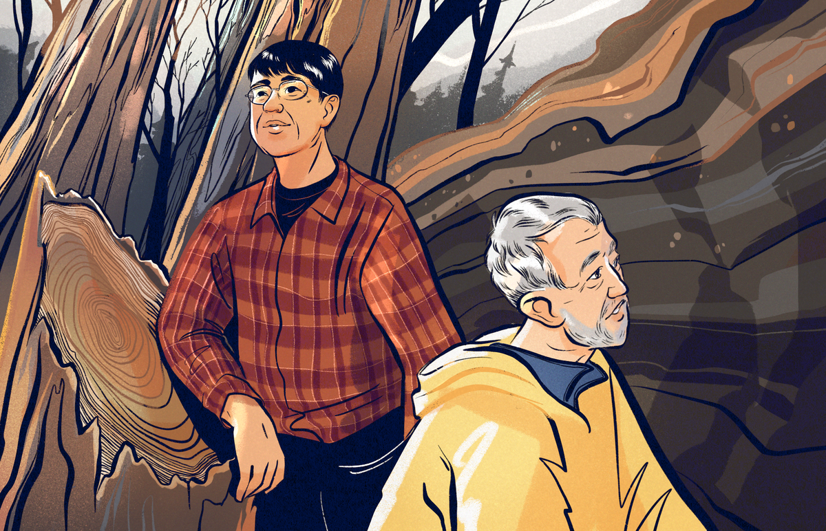
On a mild November afternoon, David Yamaguchi arrives at the Elliott Bay Book Company in the heart of Seattle’s Capitol Hill district. Old cedar bookshelves encircle the shop’s interior, rising from the floor to just out of reach. There’s so much wood here, the bookstore feels like a massive hollowed-out tree.
Yamaguchi, who is in his early 60s, sits down at a table, hoists a woven nylon case onto the countertop, and removes a piece of wood the shape and length of a thick yardstick. The wood is lined with clearly defined rings—the kind you see in elementary-school earth-science classes to illustrate tree-growth patterns. Some rings are densely clustered; others are widely spaced. Small pencil marks down the length of the specimen indicate growth years, beginning in 1986 and sprawling across the table, to the year 1430.
This old red cedarwood is one of the clues that led to Yamaguchi’s foundational discovery. In 1997, aided by the work of his peers and predecessors, Yamaguchi identified the CSZ as the source of a tsunami that flooded Japan’s coastline in 1700. The connection not only confirmed that the Cascadia Subduction Zone is active; it placed it among the most powerful subduction zones in the world. After news of the discovery spread, building codes in the Pacific Northwest were revised, and civil engineers began to strengthen cities in the region, including Seattle, Portland, and Vancouver.
Back in the mid-1980s, Yamaguchi was a doctoral student using dendrochronology—the study of tree rings—to precisely date ancient volcanic eruptions from Mount St. Helens. Rain, sun, volcanic activity, insect swarms, flooding, fire—these factors affect the chemistry and spacing of the rings such that two trees in the same location, exposed to the same environmental stressors, exhibit very similar patterns.
Yamaguchi’s work caught the attention of geologists, who speculated that if tree-ring variability could help date volcanic eruptions, maybe it could help date historical earthquakes and tsunamis too. So when a geology lecture came to town, in November of 1986, Yamaguchi was in the audience.
At the time, Mount St. Helens was exhaling clouds of smoke, as if disclosing its buried secrets. Fifty miles south of the volcano, at the Cascades Volcano Observatory, geologist Brian Atwater addressed the crowd. It was one of the first lectures he’d given since he pulled sediment samples from a muddy bank around Washington state’s Neah Bay the previous spring.
Atwater’s sediment samples were striated with layers of sand between thick layers of mud and decomposed vegetation, indicating sudden drops in land level. It seemed that waves had deposited sand and tidal silt over plant life as the land repeatedly dipped below sea level. These patterns were the first in what would become a mountain of physical evidence that pointed to an unsettling fact: The CSZ is capable of producing an earthquake of unknown magnitude at an unknown time in the future.
Yamaguchi approached Atwater after the lecture and agreed that only a major seismic event could explain the coastal land level drops. The idea was radical then: The CSZ had previously been considered inactive—too wet, too warm, and too full of sediment to build up the necessary strain for a big earthquake.
The pair hit it off, and a collaboration was forged.
It’s said that scientific progress doesn’t follow a straight line. Uncovering the CSZ’s power was no exception. Nearly a decade after Atwater’s lecture, with many stops and starts along the way, Yamaguchi and Atwater were finally close to confirming the CSZ’s destructive past and learning the Richter magnitude of its potential. Based on their preliminary radiocarbon dating of spruce stumps along Washington’s Copalis River, they knew that a major seismic event had wiped out the area sometime between 1680 and 1720.
But when, exactly, was it? Predicting the next huge quake depended on pinpointing the previous one. For that, Yamaguchi and Atwater needed help. When it arrived, it came from across the Pacific Ocean.
Japanese seismologist Kenji Satake joined the case after reading about Yamaguchi and Atwater’s radiocarbon estimate. Satake suspected that a tsunami kicked off by a major Cascadia earthquake would have traveled across the ocean, possibly affecting Japan’s coastline. When he scoured the national archives, looking for evidence of an event between 1680 and 1720, a single candidate emerged: a tsunami that occurred on January 26, 1700—smack in the middle of the radiocarbon estimate.
If the tsunami had originated off the coast of Cascadia, then there would also be dead trees along its coast. Atwater and Yamaguchi found just that: an old-growth cedar forest whose trees still had their bark, and their final growth rings still preserved. They calculated that the trees had died some time after the 1699 growing season, killed by the same event described in Japanese records.
The link between the Japan and Cascadia events was clinched. Nothing short of a magnitude-9 earthquake could have sent a seawall across the Pacific to the Japanese shoreline.
Today, there are two burning questions: When will the next big one hit? And where? With Yamaguchi and Atwater both nearing retirement, it’s up to a new generation of scientists to answer those questions.
The Newcomer
Scientists like Jessie Pearl.
Pearl is a dendrochronologist and a Mendenhall Postdoctoral Research Fellow at the U.S. Geological Survey. Like Yamaguchi, she looks to the past to predict the future, gathering data that helps earthquake and tsunami modelers improve current hazard maps.
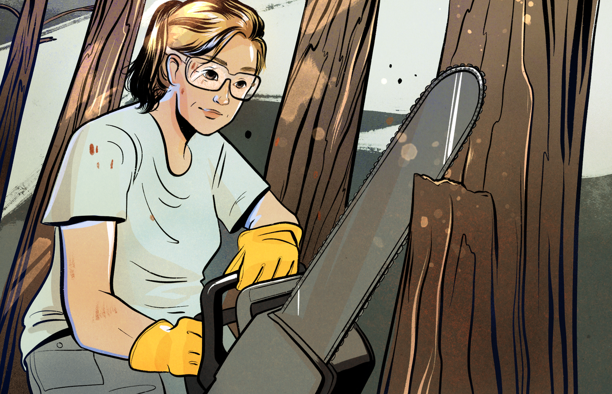
Armed with a chainsaw, Pearl cuts into tree stumps to learn about extreme climates. She used to study hurricanes on the East Coast; now she focuses on seismic events on the West.
On a chilly fall evening, Pearl navigates Seattle’s hilly streets toward Town Hall, where a Pacific Northwest earthquake forum is scheduled to kick off within the hour. In rushed, excited bursts she describes her admiration for the scientists who came before her and have made her work possible.
She gushes about trees too, ascribing them near-superpowers—how they record climate and weather information, for instance, often better than scientific instruments do. Two months into her fellowship, she’s buzzing with potential. All of her Cascadia discoveries are in front of her, and she’s eager to get started.
Pearl is a self-proclaimed boots-on-the-ground data gatherer. As she says, “There’s no such thing as bad more data. More data is always good.” The more data that’s gathered, she says, the better the models are at simulating real-world events.
Science is often a negotiation between cost and the likelihood of discovery. An expensive expedition with a small chance of yielding new information is unlikely to secure funding. “We are at fault for going after what’s easy and cheap,” Pearl acknowledges, “because that’s where you’re going to get the most bang for your buck.”
But when modelers notice gaps or irregularities in their models, they can justify the cost of sending scientists into new and unexplored territory. It’s these data gaps in the latest seismic models of the Pacific Northwest that Pearl aims to fill.
Over the next two years, she’ll comb Cascadia’s coastline, wading through waist-deep mud thick enough to swallow boots and immobilize chainsaws. In old, dead forests, known as ghost forests, Pearl will extract samples from ancient tree stumps. In their rings she’ll look for evidence of past seismic activity from before the year 1700. From this information she’ll be able to provide better estimates of how much time usually elapses between major seismic events in the CSZ. By comparing affected and unaffected trees in the region, her work will also reveal which areas were touched by tsunami waters, and how, and when.
To do that, Pearl will need access to Indigenous lands and collaborators in those coastal communities—people like Leitka, who understand the importance of both scientific inquiry and territorial protection.
Yet the CSZ isn’t the only place in Cascadia where myth preceded science, or where crucial earthquake insights can be gleaned by merging data-driven analysis and traditional oral history. One Indigenous story, told in many versions by many communities, is known as the Bridge of the Gods. It describes a natural footbridge that once arched over the Columbia River between Oregon and Washington.
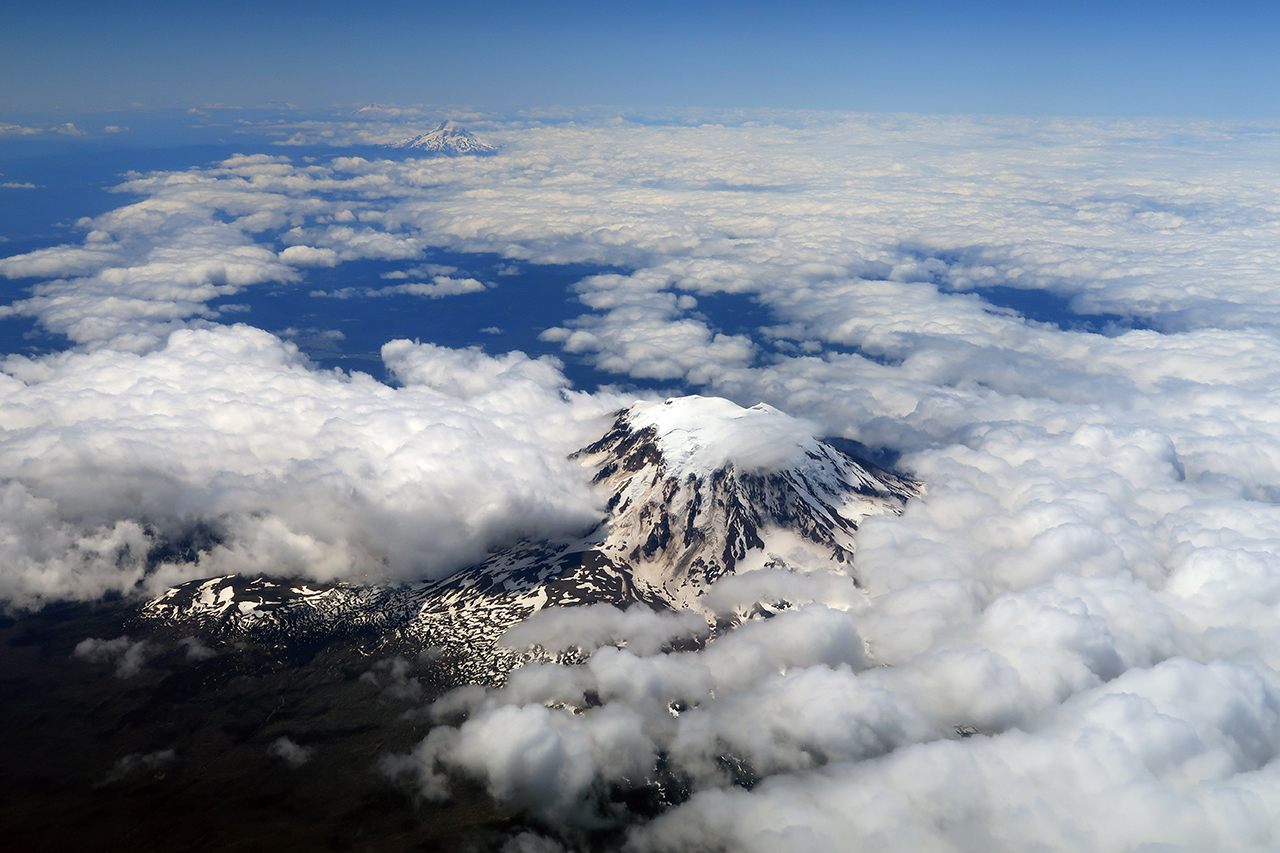
According to the story, brothers Pahto and Wy’east fought for the affections of a beautiful woman named Loowit. Their jealous rage ignited fires that spread through the forests and shook the earth, until the bridge collapsed into the river. As punishment, their father, a powerful chief, turned the brothers into mountains. Pahto became Mount Adams; Wy’east became Mount Hood.
Radiocarbon dating and dendrochronology estimates suggest that a major seismic event did, at some point, occur in the area. But what caused the Bridge of the Gods to collapse, and when exactly it happened, remains an open mystery.
Today a cantilever bridge stands where the mythical one is said to have fallen, made of steel instead of earth. Built in 1926, it was erected before anyone knew the hazards of the CSZ.
Now scientists, including Yamaguchi and Pearl, hope to shed light on the old story. Pinning a date and a cause to the bridge collapse would give a more resolute history of seismic events in the region. The findings might also provide a glimpse into the future—something that will help predict what might happen to the modern structure, and to any unfortunate souls who happen to be on it when the CSZ fractures again.
In a seismically retrofitted building in Seattle, the public forum on earthquakes is set to begin. Citizens and scientists take their seats. Pearl and Yamaguchi are among them—two generations of a scientific family.
A series of short lectures led by seismologists and city planners tells attendees what to expect when the next megathrust earthquake hits.
First, the good news: Automatic shut-off valves for natural gas will mitigate fire risks, helping to compensate as Seattle’s 200-plus active-duty firefighters are quickly overwhelmed. Shatterproof glass installed in newer buildings will limit the shards that rain down into the streets. Steel collars wrapped around concrete columns in parking garages across the city will prevent “pancake collapses” similar to that of the World Trade Center’s twin towers in 2001.
Still, says emergency-management director Barb Graff, “No matter how we look at it, it’s going to be a horrible day.”
The audience’s eyes glow as magnitude-9 earthquake simulations project on a screen at the front of the room. Skyscrapers undulate like Jell-O molds, and the crowd laughs nervously at what feels like the impossibility of it all. On another slide, multicolored seismic waves radiate from an epicenter and creep up the coastal map. First they hit the building hosting the public forum, then travel toward the Nisqually region, where Leitka is getting ready for bed on a late Wednesday night.
The presentation is the culmination of every CSZ insight gleaned—and every subsequent emergency-preparedness measure taken—in the past 30-plus years. The findings and progress are impressive, but they’re far from complete. Cascadia needs more Pearls, Yamaguchis, Atwaters, and Leitkas—more people willing to spend their lives studying this land and extracting secrets from its past, safeguarding its future, and protecting its people.
But is there enough time for the progress that’s needed to save thousands of lives? And when—and how—will we find out?
* Correction: This story was updated to include a photograph of Mount Hood and Mount Adams instead of Mount Hood and Mount Rainier.






Follow us on Twitter to get the latest on the world's hidden wonders.
Like us on Facebook to get the latest on the world's hidden wonders.
Follow us on Twitter Like us on Facebook