Jarvis Island, the Cycling Hotspot That Wasn’t
Why an abandoned guano atoll was once one of the most popular virtual bicycling routes in the world.

This past November, the fitness app company Strava released the latest version of their Global Heatmap: a map that reveals popular exercise routes around the world by charting data from over a billion runs, bike rides, and cross-country ski trips. Some of these routes are obvious. For example, the paths through Manhattan’s Central Park are lit up like a Christmas tree.
Some of them are slightly more surprising. As international security student Nathan Ruser pointed out over the weekend, the heat maps may be revealing common exercise and patrol routes around military bases.
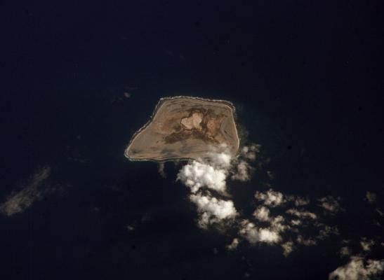
If you mouse around a little more, though, you’ll see something else strange. In the middle of the Pacific Ocean, hundreds of miles from any populated land mass, there’s a clear pinprick of activity. Zoom in, and you’ll see a tiny island, completely covered by a perfectly symmetrical track, white-hot with hundreds of thousands of recorded rides. Congratulations, you’ve found what was once one of the most popular virtual bicycling routes in the world.
I have no idea what’s going on on Jarvis Island pic.twitter.com/lRPAvLMvjp
— Jack Nelson (@jack_dot_bin) January 28, 2018
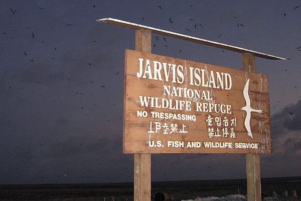
The strangely-shaped route is on Jarvis Island, an unincorporated, unorganized, and uninhabited territory of the United States. Like other islands in the South Pacific, it’s mostly notable for its wildlife, which is federally protected, and its rich guano deposits, which were mined for fertilizer until the beginning of the 20th century. Jarvis Island has no residents and very few visitors, pretty much all of which are scientists, U.S. Fish and Wildlife Service employees, or members of the Coast Guard.
In other words, people aren’t actually bicycling there—it just looks like they are. How did this happen? The answer has to do with another exercise technology company, Zwift. Zwift basically allows you to bike indoors while feeling like you’re outside: You put the back wheel of your bike on a sensor-enabled gadget called a “trainer,” put a computer, TV, or phone screen in front of you, and pedal away. As you bike in place, the screen makes it look like you’re traveling through a virtual course, competing with other riders in other basements across the world.
Many Zwift users wanted to track their indoor training rides on Strava—but since their physical coordinates weren’t changing, the app didn’t recognize that they were moving. And so, as the Zwift Insider blog explained, the company found a workaround. They used the GPS coordinates for Jarvis Island, and pretended everyone was racing there. They called the course “Zwift Island,” and filled its virtual scenery with a sequoia forest, a fishing village, and a blimp.
Zwift retired the Zwift Island course in March of 2015, replacing it with other virtual rides (two of these, Richmond and London, are geo-located in the places they’re based on, while one, called Watopia, is pulling a Jarvis-esque trick in the Solomon Islands). At that point, nearly 5,000 people had “biked” the Jarvis Island “route” about 130,000 times, which was enough to ensure its place on the Strava heat map.
It was also enough that some cyclists are now nostalgic for this particular fake experience, and have asked the company to open it up again for old times’ sake. “Jarvis Island is perfect,” one wrote on a support board. “I… even feel [the] kind forest breeze when riding [there].” Score one more for islands full of bird poop.


Follow us on Twitter to get the latest on the world's hidden wonders.
Like us on Facebook to get the latest on the world's hidden wonders.
Follow us on Twitter Like us on Facebook