Prehistoric Sand Is Full of Secrets
Petrified wave ripples can tell us about the weather that dinosaurs saw.
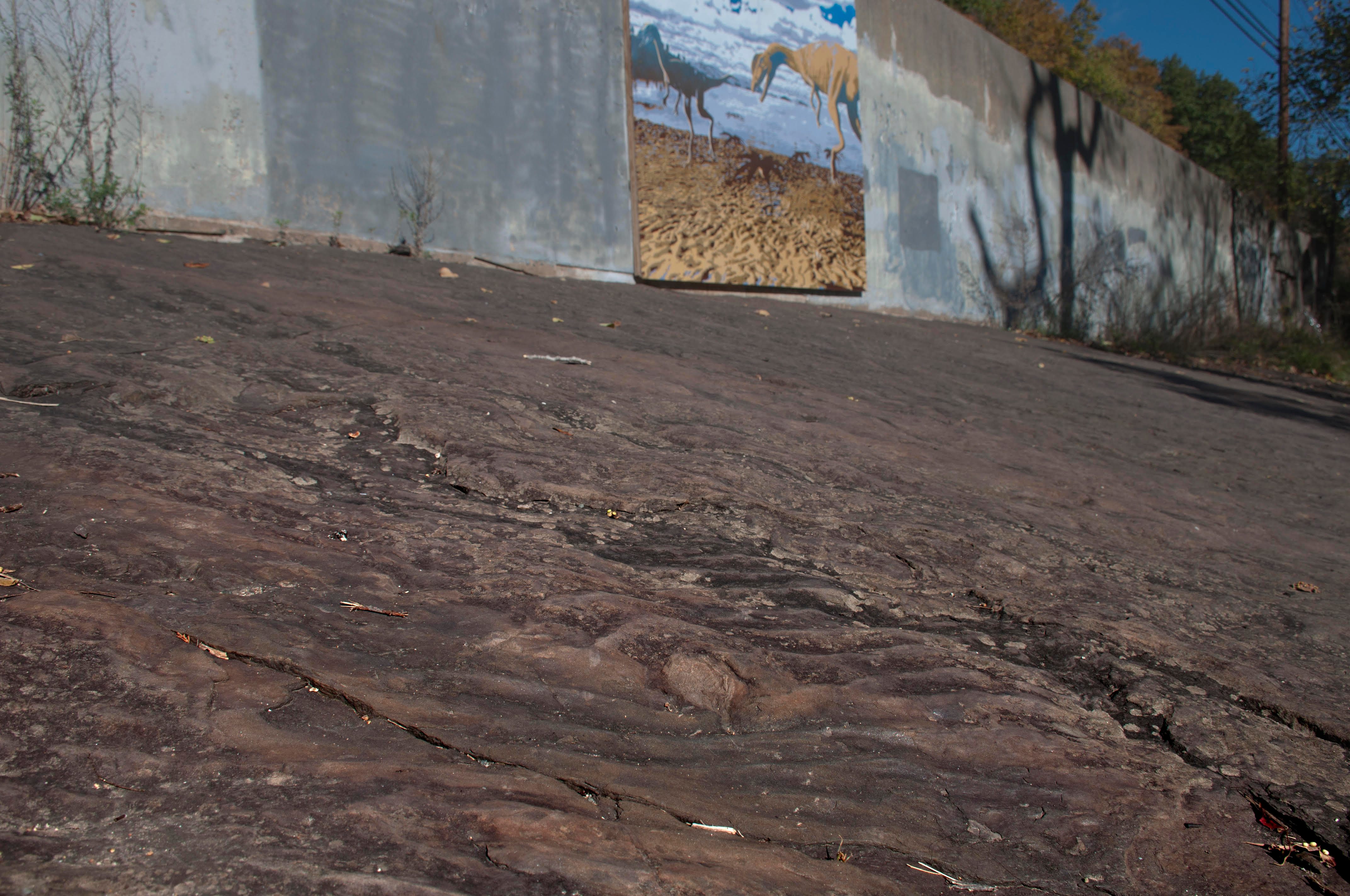
South Hadley and Holyoke, Massachusetts, are famous for their tracks. Around 200 million years ago, when the Connecticut River Valley was full of swamps and shallow, muddy lakeshores, dinosaurs tromped through and left footprints in the muck, which were then sealed off and preserved. Today, at Dinosaur Footprints Reservation, sandwiched between two highways and railway, visitors can spot hundreds of these imprints in the sandstone.
Around these fossils, made by three-toed feet with sharp claws, the ground tells other stories, too. If you look closely, you’ll see that the rock is rippled. These are shallow seabeds, petrified. To the experts who know how to read them, they tell a vivid tale about the prehistoric world—right down to what the weather was like when a dinosaur went out for a stroll.
That’s why Taylor Perron, a geologist at the Massachusetts Institute of Technology, recently took his students there for a visit. Perron studies erosion and landscapes, and finds detailed stories in bands of sand.
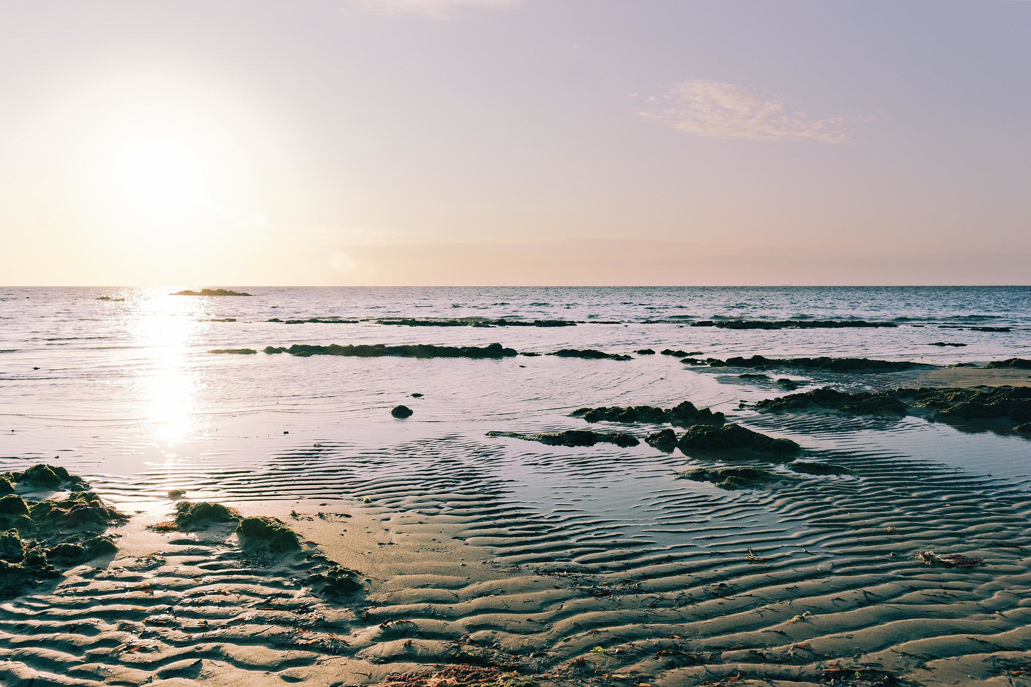
These ancient formations are known as wave ripples, and are just like the ones that can be found on a sandy seashore today (but different from the ripples formed by currents or wind). Wave ripples grow as passing surface waves deposit sand on ridges and carve depressions between them. These sedimentary formations usually max out at an inch or two in height before the sand begins to slide in little avalanches, or are wiped out by other waves.

It might seem implausible that a wave ripple could last an hour in such a dynamic environment, let alone a millennium. “They’re so delicate,” Perron says. “If you go up to one in the water at the beach and you just touch it with a toe, you can make a big hole in the ripple; you can wipe it right out.” The ripples are almost always short-lived, but the ones that manage to hang around do so because of storms or exposure. A muddy river that overflows and spills wet sediment on the shore could blanket the sand and “form a kind of armor over the ripples beneath,” Perron says. They can also survive by being exposed above the water’s surface—say, by an earthquake or receding tide—where they can dry and solidify in place. Petrified ripples are a sedimentary snapshot of the moment that they were buried.
Researchers know that water depth and wave size affects the size and spacing of wave ripples. Though they’re often rather linear and parallel, they can split and reconnect to form a variety of puzzling patterns. Scientists know much less about the specific conditions that create these, or what they can tell us. During a sabbatical at MIT in 2010, Paul Myrow, a geologist at Colorado College, showed Perron some puzzling photographs of preserved wave ripples from the Cambrian in Newfoundland, and the Proterozoic in both Inner Mongolia and the Apache Group in Arizona, among other places and vintages. The images show ripples in scores of these different patterns, known as “defects.” Some look like hourglasses, others evoke tuning forks. “We couldn’t explain them,” Perron says. “We didn’t know how they formed, and we didn’t know what they meant.”
They had the idea that they might be able to decode the patterns by reverse-engineering them. As the team describes in a new paper in the journal Geology, they set up 23-foot-long experimental tank in a lab at MIT. They attached a paddle to one end that allowed them to create controlled waves that traveled the length of the tank. At the other end was a mat of rubberized horsehair to absorb the waves so they wouldn’t bounce back. Between the horsehair and paddle was a flat expanse of sand. The researchers could then track how changes in the speed and motion of the paddle changed the resulting ripples.
When the paddle was swished through a narrow range of motion, the ripples formed hourglass patterns. When the waves were even smaller and faster, “secondary crests” appeared on each side of existing ripples. A wider range of motion yielded zig-zag patterns. The researchers suggest that strong storms could probably create hourglass shapes or secondary crests offshore, while closer in, a falling tide with constant wind could form zigzags. Tracking these shapes through the geological record, Perron says, could help researchers identify significant storms or fluctuations at a literally granular level. “If you see these types of defects in nature, we argue that the seabed was undergoing some kind of change in weather conditions, tides, or something else that affected water depth or waves, probably over the course of hours or days,” Perron told MIT News. “For instance, if you’re seeing lots of secondary crests, you can tell there was a pretty big change in the waves as opposed to a smaller change, which might give you hourglasses instead.”

Looking at the ripples can help researchers fill in a picture of that environment at a specific moment in time—even hundreds of millions of years ago. At his field-trip site in Massachusetts, Perron says, the ripple patterns aren’t too complicated. There are occasional tuning-fork-like splits, which seem to be correlated with periods of consistent waves and water depth. Judging by the shape and spacing of the ripples, Perron says, it was probably a pretty comfortable day when the dinosaurs left those tracks—not too windy, no pounding storm.
In addition to functioning as an type of ancient almanac, ripples can, alongside tracks, say something about dinosaur behavior. In a 2015 paper in the Bulletin of the Peabody Museum of Natural History, Patrick Getty, then a visiting geoscientist at the University of Connecticut, pointed to the orientation of ripples and tracks as evidence that the animals were skirting the shoreline instead of moving in or out of the water.
Perron doesn’t expect that the average visitor checking out the dino prints in Massachusetts will be as bowled over by the little crests and valleys, or see their value to a trained scientific eye. “Dinosaur footprints are pretty tough competition,” he says. But because the ripples are easy to see, well-preserved, and convex, people do notice them, says Josh Knox, a stewardship manager of the Trustees of Reservations, the nonprofit organization that looks after the site. This summer, artist Will Sillin installed a mural on a wall near the tracks and ripples, which depicts dinosaurs ambling along a shoreline hatched with ripples—a visual echo of the preserved tracks and ripples just below it.
The tracks are the stars that bring out the audience, but the ripples—which sometimes occur in layers, stacked atop each other like a geological flipbook—provide the backdrop to a scene 200 million years in the making. “Maybe we should rename the reservation Trace Ripple Fossil Reservation,” Knox jokes. “I don’t know if it’s as catchy.”










Follow us on Twitter to get the latest on the world's hidden wonders.
Like us on Facebook to get the latest on the world's hidden wonders.
Follow us on Twitter Like us on Facebook