AO Edited
North Truro Air Force Station
This abandoned radar station from the Cold War era now only broadcasts a seriously ominous air of isolation.
Built in 1951 as a response to the Russians testing their first atomic bomb, the North Truro Air Force Station became one of the first radar listening stations to monitor for Soviet bombers. The station was decommissioned in 1994 upon the end of the Cold War and most of the land was sold to the National Park Service as part of the Cape Cod National Seashore. The grounds are still open to the public and the Park Service conducts regular guided tours.
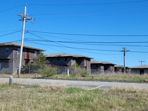
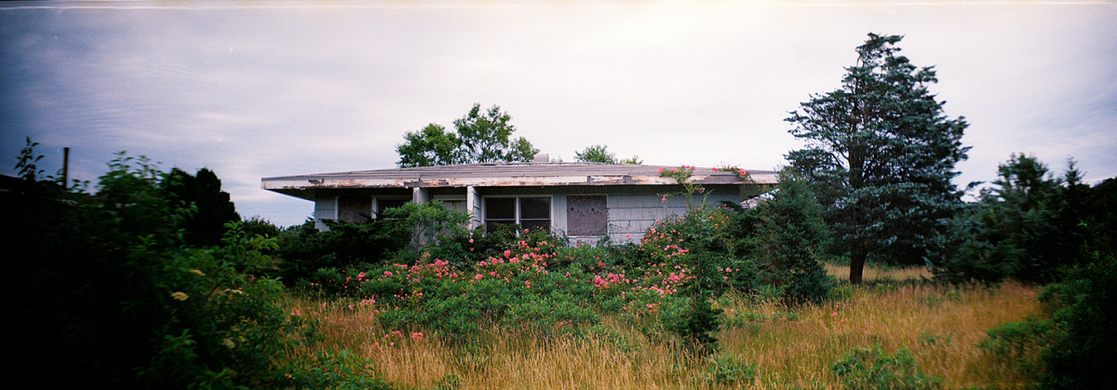
The station now is a collection of dilapidated barracks, officers’ quarters, technical buildings and offices, as well as a bar and a bowling alley. The concrete pads that serve as bases for the radar dishes are still in the ground but the radar dishes themselves have been disassembled. A few buildings have been renovated such as the library and a classroom building however nearly all of the other buildings contain asbestos and mold and are too hazardous to enter.
The “neighborhoods” of family housing have been mostly untouched since they were built in the 50’s and since the exteriors are made of weather-resistant asbestos tiles, they’re likely to remain so. The grounds for the most part remained uncared for, probably for health reasons. This area is basically frozen time and would make a perfect outdoor movie set for some post-apocalyptic thriller.
Though mostly empty, the grounds are now home to the Payomet Performing Arts Center, an atmospheric research lab as well as National Park Service facilities.
Update as of June 2021: High Fences surround most of the area and it is mostly off-limit to the public. Please do not trespass.
Know Before You Go
Parking is provided. Bring your bicycle, but be careful- there are major cliffs at the end of some of the roads that will drop you 100+ feet to a remote beach, with no warning. It has an overgrown path that goes around the base, taking you past the asbestos-riddled houses. Maps are provided. The area is home to an outdoor preforming art center. Also, the Cape Cod lighthouse is right next door. It's open daily for tours. It has a beautiful view of Provincetown from the top of the tower. Also check out the North Truro Historical Society museum, which is on the way to the lighthouse.
2022 update: the base is now fenced off and mostly closed to the public. The roads around the exterior can still be accessed via a pathway through the woods. Drive to the base entrance until you see the "road closed" sign, then make a right onto the dirt road (appears as "Old Kings Hwy" on Google maps). Follow this for half a mile until you see a small pull-off on the left , in front of a sandy trail. It's a 10-15 minute walk down this path to reach the base. Be cautious of ticks.


Follow us on Twitter to get the latest on the world's hidden wonders.
Like us on Facebook to get the latest on the world's hidden wonders.
Follow us on Twitter Like us on Facebook